Reno Park Update 090804B: Transit Fade

Ok, so for the second set of transportation analysis, I’ve compared transit accessibility to lot areas. Even without buildings, it’s possible to get a sense of the transit-accessible public space here. Areas that are lighter have more transit options. Again, Tenleytown is a hub of activity, where the blocks around the circle and the Metro stop are major transfer points that get a lot of street traffic.

property-transit

So, Chevy Chase isn’t really the most transit-accessible place in the world. Even if I had used a 1/4 mile radius for buses, there would have been a dark spot there. Also, note that the commercial strip between Fessenden and Ellicott streets is in the 1/2 mile radius overlap between Tenleytown and Friendship Heights, which may contribute to its success, in spite of being somewhat isolated by the hill to the south. Read on for a breakdown of plans.

Middle path density gets some news

Option A
Option A (by nydiscovery on flickr)

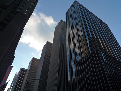
This  past weekend, the East Bay Express (a paper in Oakland), wrote a fairly balanced article about the battles over densification in Oakland and Berkeley. Although it took as its subject a particularly acerbic debate over local development projects, the scenario is the same everywhere. The article presents three largely oppositional theses: tall buildings are environmentally sound, all density is environmentally unsound, and that density can mean Paris as well as Manhattan. Each one is given a fair voice, but ultimately only the middle path comes out looking informed.

Of course the commenters jumped out of the starting blocks and onto their respective causes: the electric car, renewable energy, zero population growth, THE IMPORTANCE OF WRITING EVERYTHING IN CAPITAL LETTERS, planting “subsistence” gardens in quarter-acre lots, and obviously the meme that developers are profiteers and gentrifiers. But what none of these people seemed to see was that the options of a pleasant human environment and a limited footprint on the natural world are not mutually exclusive.

Option B (from baslow on flickr)

Read the article; take a look at the section on pages 3 & 4 in particular, where Mike Pyatok, an architect with decades of experience, drops the usual truth bombs.

In an environment with artificial scarcity by way of outdated and strict zoning, the costs of land allotted to tall development, prices will be too high, even for luxury development. 5-8 story buildings are cheaper, more comfortable, and more energy efficient on a regional scale. Similarly, the need for a large footprint to justify the vertical costs means a less refined urban grain and less human-scale detail and fewer potential owners.

As long as cities are lusting for the skinny towers of 1920s New York, opponents will only see a superblock grime of the 1970s. Unfortunately, those skinny towers never made much money and definitely won’t nowadays. So, many opponents are simply reacting to unreasonable visions of the future with equally wrong visions of dystopia. Expect to see knees jerking until city councils and armchair planners ask for middle density.

North of Tilden: Rock & Roll, P&P, and Lord & Taylor’s

Three minor news items in the Upper Northwest:

sweater-set
The Sweater Set get ready.

1: The first two Fort Reno concerts were a smashing success, with at least 300 people showing up to listen, eat, and frolic on the grass around the stage. Monday night’s show was a fun mix of different styles. The Sweater Set delivered on their ultra-indie promise to give a twee multi-instrument set. Funk Ark played some solid 70s funk that made the sudden arrival of a Park Police car seem a little too like a cop movie, especially when teens started fleeing the concert with black plastic bags. Lastly Pash led the night out with a harder energy, although the lead singer’s vocals were drowned out in the mix, which took away a lot of the melody.

The second night began with noon:30, who added some soul-like vocals to cool and muddy indie rock. They’re having an EP release party on July 4th. Meow vs. Meow followed up with a harder sound with a lot of strong rhythm. Lastly, the Electricutions played the crowd out, just after the sun had totally left the horizon. There’s another show this Monday and another on Thursday, but more on that later.

friendship-home-plate
Plenty of potential connectivity.

2: National Realty & Development, the owners of Lord and Taylor’s, have announced plans and received approval to build a one-story commercial building on the “home plate” parking lot behind Mazza Gallerie. The Northwest Current’s reporting mentions that the original lease between L&T’s and Mazza called for the parking lot to be used as a car park in perpetuity. Now, the unanimous and quick vote of the council is to turn it into a walkable shopping district, competing with the deluxe stores along Wisconsin Avenue. Could still have some height on top of that, but apparently the 50-year lease ends in 15 years, so development won’t have enough of a payoff for them. Completion of the five stores is expected for early 2011.

3: Politics and Prose, the cultural institution at the border of Tobago and Chevy Chase, announced its schedule for July/August. You can look at the schedule, but here are the authors presenting books on urban issues:

  • Wednesday, July 8th, 7PM: Alyssa Katz will discuss her book on the foreclosure and mortgage crisis, Our Lot.
  • Friday July 10th, 7PM: Reloville, by Peter Kilborn, examines large subsets of suburban residents whose livelihoods depend on not forming close ties to the local community and frequently moving on to a new job.
  • August 11th, 7PM: Jane Jacob’s struggle with Robert Moses, and the issues it was born of, are retold in Anthony Flint’s Wrestling with Moses.

Maybe I’ll see you there. It’s not too accessible, but you can take the L1,2,4 or the M4 from Van Ness and Tenleytown Metro stations, respectively.

Rename or un-name the Bi-Purple County Line Transitway while it’s still possible (or cheap)

So the political wars over the Purple Line largely ended last week, when the light rail option was selected over the BRT one by the National Capital Transportation Board. The decision now frees the transportation enthusiast crowd to fight over petty and superficial little things, like, for example, the name.

The name “Purple Line” was born back to a day when a legitimate discussion was ongoing between an outer heavy rail line, and the inner light rail line. More specifically, it was born when the Bethesda-Silver Spring light rail line was a separate project from the Silver Spring-New Carrollton Purple Line altogether. But they were merged sometime back under Gov. Glendenning (Wikipedia says it was under Erlich, but that contradicts my memories), and suddenly everyone stopped paying attention to the PG County side. Governor Erlich had the decent sense to not oversell the mid-tier transit line, but managed to make the name situation worse. His DOT’s name, the Bi-County “Transitway,” is an unadulterated sample of bureaucraspeak, managing to say absolutely nothing about anything, while also sounding incredibly unexciting. Bi-County? Which counties? Washington and Allegheny? Marin and Cook? Transitway? There’s no meaningful thing that the term “transitway” promises, although it does sound a bit like a moving walkway or even a slidewalk. I hear that when you visit the mausoleum of Kim Il-Sung, they have one of those things.

But calling it the Purple line unfairly associates it with heavy rail lines that operate in a very different way. Mixing the modes damages the legibility of Metro’s human-interface concept, embodied in its map. More importantly, it disassociates the particualr line from its value as part of a larger network of streetcars. When extensions are made elsewhere and it is connected to the Georgia Avenue Streetcar, it will be possible to run trains from Bolling AFB to Bethesda. Rather than hype up one particular service, instead reminding potential riders of the total extent of the system will likely increase ridership.

Frankly, I think any distinctive branding should simply disappear into the area’s future streetcar network. David Alpert had it right in his metro scheme, simply drawing all overground rapid transit purple. But if named it must be, then let’s go with this spiffy dollop of NIMBY fears, presented in the style of Jim Graham:

That Bastard O’Malley/Erlich/Glendenning’s Inflationary-Federal-Fiat-Currency-Funded-Puce-Hued- Two-County-Not-Underground-New-Carrollton-Silver-Spring-Chevy-Chase-Bethesda-Oh-God-Won’t-Someone-Think-of-the-Trees/It’s-a-Combine-Harvester-for-Toddlers-All-Singing-All-Dancing-Thug-Travelator.

Anyone have a better idea? I, for one, can’t wait for the epic battles between the Sharks and the Jetsons.

Macomb Giant: Where to from here?

The Zoning Commission has approved the Macomb-Wisconsin Giant project, after a difficult and involved process that began in 1619 1998.  Jeff Davis posted on the Cleveland Park Listserv about it this morning:

Last night, the Zoning Commission voted unanimously (4 to 0) to approve the
Giant PUD Application. The zoning process was robust, transparent, and fair and it yielded a terrific overall result.

He’s right, the overall result is excellent urban planning and competent architecture that  adds considerably more and better density to a major thoroughfare, while also managing to unite a mottled context of various building types and styles. The architects, Street-Works, have produced excellent cityscapes work in Shirlington, Reston, and Bethesda. Based on their prior experience, it’s safe to predict that the project will be a success. More than that, I predict that the already thriving area will become a new locality, a broad place that people will perceive intuitively as distinct from Cleveland Park and Cathedral Heights. 

And that’s a good thing, because Wisconsin Avenue needs more of this healthy density. The example that this sets will be a lesson to Ward 3, demonstrating how a few stores and few more stories can create an enjoyable neighborhood center. Not only will the extreme non-failure of the site be ammunition for people who support smart growth, it will serve as a billboard for those who are not engaged in debates, that urbanism is possible in Northwest. But it will be some time before the buildings are built and the storefronts occupied, so until then, activists for urban neighborhoods will have to focus on two things.

  1. Getting there. One of the criticisms of  the new project stemmed from the limited mass transit options in the proposal, legitimate concerns that need to be addressed. WMATA needs to step up bus service and introduce an express line on Wisconsin, either to Georgetown or Woodley Park. Bus facilities such as bus bulbs need to be added to Wisconsin, even at the expense of roadway space. Likewise, DC ought to facilitate the placement of SmartBike facilities, bike racks, and carsharing spaces.
  2. Connecting the surrounding neighborhoods. People must be able to walk to the new development. The current plans emphasize pedestrian traffic, but DDOT needs to improve the streetscape around Macomb, to lure neighborhood residents off of side streets. Without buffering from Wisconsin or new signals along Wisconsin, pedestrians lose the calmness that makes walking so appealing. 

Those who fought hard to get the right kind of development should not give up the momentum they have now, and instead should fight for even better facilities. This includes opponents, who should still look to make the area as leafy as possible, and ensure that Giant sticks to its promises. Resident involvement is one of the most crucial parts of developing community, so although the fight over the Giant has been so acrimonious, it’s important to realize that it will happen, and anyone interested must remain involved in working to ensure good growth elsewhere in the neighborhood.

Biggest urban gamble of the past 20 years opens

The High Line opened today. The much-vaunted and extremely chic park built on a former railroad viaduct south of Penn Station will be a test of both urban design theories and the exceptionality of New York. Diller Scofidio + Renfro have built what appears to be a truly beautiful modern park that appeals to theorists as much as hipsters and bankers. It’s also an elevated pedestrian structure, with limited access and some other design decisions that contradict basic public space design practice. But it’s popular and it’s going to get a lot of attention; many cities are already looking to copy it. 

There hasn’t been a place in New York that deserves close  observation since the West Village in 1961. The degree to which this works could change the way governments approach marginal spaces, just as the Embarcadero and the Central Artery/Tunnel projects have show the civic potential of highway removal. We’ll just have to wait and see if this is the same.

United States Bicycle Route 101

br101
br1

Did you know that the United States has signed bicycle routes? You didn’t? Yeah… don’t feel bad, nobody else seems to know about them, and I only stumbled upon them trying to do this month’s Wikiglean. Obscurity notwithstanding, two bike routes do exist and the legal framework is still around – and right now is just the time to breathe life back into the system and make them serious transit.

Back in the 1970s, after the shock of the Oil Crisis, planners – AASHTO even – had the forward idea of determining and assigning interstate bike routes.  Primarily meant for low-traffic roads or dedicated trails, the routes were to connect cities for touring purposes. However, by 1982, only two routes had ever come into being, and so the system went the way of the DMC-12. But conveniently for Washingtonians, the two existing trails currently run through Virginia and one is poised to benefit the Washington Metropolitan area.

Height is not an urban strategy

Over the weekend, notable urban-issues political wonk Matt Yglesias wrote a passionate and well-meaning argument for greater density in the DC area that got it completely wrong. Yglesias claims that DC is suffering culturally and economically due to its height limitation, which inhibits the extreme density seen in Chicago or Manhattan. It also results in an uninteresting skyline to boot! Alas, he unconsciously bases his speculation in outdated thinking that assumes that commuter town is the optimal configuration of a city.

Washington in 2056
Magnacar dependency does not make a better Rosslyn.

Yglesias makes three arguments: taller buildings with will increase tax revenue, improve livability, and reduce what he calls “job-sprawl.” In each case, he is partially correct, but also misses broader issues of urban land use and planning. Primarily, he misunderstands the qualities and causes of density, mistaking the unique and exceptional conditions that created metropolises like New York, Chicago, Tokyo, and Paris for natural growth.

DC area stimulus projects – Updated!

I’ve updated my map of DC-area stimulus projects to reflect some that were missing last time and added stimulus projects in Montgomery and Prince George’s Counties. I’ll add projects in Arlington, Alexandria, and Fairfax when they are publicly approved.


View DC Area Stimulus Projects in a larger map

DC’s Shovel-Ready Projects

This monday, Mayor Fenty signed and submitted the section 1511 certification to request funds for the first round of highway under the stimulus bill or the ARRA, as the hepcats in the GAO call it. Despite it being for “highway funding” the $57,650,000 will go to eight items that are actually quite urban. Almost every project includes some benefit for pedestrians or the city, and at least two are primarily for them: the Great Streets Initiative project on Pennsylvania Avenue and sidewalk enhancements across the city. Take a look at the projects in the map below, or follow after the break to see a list of projects as well as well as a few proposed ones that didn’t make it. 


View Larger Map