McMillan Two envisions a Classical Anacostia

mcmillan-two-anacostia-quay

The public character of Washington has grown around two grand plans. First, Charles L’Enfant laid out the city as a sacred grove for the marking of America’s history. One century later, the McMillan Commission restored and expanded upon that original design to include the history of the Nineteenth Century. Now, The city center has grown up in the second hundred years since then, enough for Congress to declare the Mall closed to new development. Meanwhile, the rest of the city has built up or spread out into suburbs. In light of the last fifty years, a group of traditional Washingtonian architects have developed an audacious proposal for the next lifetime of growth, McMillan Two. Fulfilling some less-known intentions of the McMillan Plan with slight modifications, this plan essentially calls for bringing Paris, mansard , Seine and all, to the Capital of the United States.

Developed by the Build DC Initiative and architect Nir Buras in particular, the design has been sponsored by the Mid-Atlantic chapter of the Institute of Classical Architecture and Classical America, the National Civic Arts Society, with some support from the DC chapter of the Congress for New Urbanism. Buras’s philosophy draws hard from tradition: we know what is beautiful and what works – and we should do that. Downplaying strident formal innovation, the relationship buildings have to precedents in a cultural tradition guides design. For McMillan Two, France provides that tradition, particularly L’Enfant’s garden models and the Beaux-arts education of Burnham, McKim, and Olmsted. Though the partners have kept much of the project under wraps, Buras has recently begun sharing the outlines of this radical rethinking of DC’s future, namely that “Washington remains the most beautiful city in the nation.”

current-anacostia-plan
Near Southeast today. All images courtesy Nir Buras.

The McMillan Two plan

Two Steps Forward and One Step Back

Cross-posted at Greater Greater Washington.
This past week, Safeway revealed their plans to renovate the Safeway at 42nd and Ellicott Streets, along Wisconsin Avenue in the northern reaches of Tenleytown. What they propose (huge PDF) is a dramatic improvement over the bunker-like current building, and will enliven a dreary section of the neighborhood. However, the project includes no residential or commercial component on top of the new stores, despite its location roughly one-half mile from both the Tenleytown-AU and Friendship Heights Metro stations. Like the TD Banknorth building across Wisconsin Avenue, these patches in the urban fabric will better the community, but without more of a plan, they are just patches.

The new Safeway will activate 42nd Street, which is separated from Wisconsin Avenue by just a small triangular park. Instead of a forbidding blank wall, Safeway plans some outdoor seating for an in-store Starbucks. Residential Ellicott Street will get a landscaped park in front of the store’s substantial setback. The surface parking lot will become an enclosed one-story parking wing, and the loading dock will move to Davenport Street, adjacent to Georgetown Day School, screened from the street by a brick wall.

Courtesy the ARD (how nice of them) and Torti Gallas
Courtesy the ARD and Torti Gallas

Unfortunately, Safeway wanted to be expedient with the design and worked with one of the five neighborhood organizations that claims to represent the community, the Alliance for Rational Development. As their double-plus inaccurate name implies, ARD opposes most, if not all development of sites along Wisconsin and in Tenleytown. Their policies are transit-oriented-denialist, insisting that the area is optimally zoned and built up, and that any more growth will only have negative effects, primarily on the supply of parking.

Some of their concerns for any given project can seem legitimate when viewed without context, ignoring of the multiple benefits of well-designed areas with mixed uses. But Tenleytown’s zoning only allows for densities along a very narrow band on Wisconsin Avenue, closer in form to a suburban arterial than an interconnected city neighborhood. Many other lots, just a block or two from the Metro have no opportunities for development at any scale, because they are zoned as low-density in spite of their location at a major node in the city’s infrastructure network.

North of Tilden: In the name of the Father, the Builder and Community Spirit

The Tenleytown area has been a hub of hubbub for the past two weeks, and more is to come. Four long awaited projects made great strides, however, opportunities are still being lost.

First the good news: The Tenleytown Library will break ground today, September 23rd at 10:30 AM, with Mayor Fenty and perhaps some protesters in attendance. The Economic Development office decided to spend $650K-1M to build stronger girders in the rear of the building, to permit future growth above and to the rear of the library. Across Wisconsin, the renovated and restored fields at Fort Reno Park will open on October 3rd. Another contentious site, the three athletic pitches look great. I can’t wait to see people enjoying the park and all its earthly delights again.

The new structure is on the left. Pray for a good contractor.
Top: Yuma Elevation, new structure at left. Bottom: Western elevation. (Image via DCMud)

Opus Dei revealed more details about their plan for the Yuma Study Center, a residential and educational facility behind St. Ann’s Catholic Church. Going before the HPRB, Moses of the Anacostia Nir Buras presented a handsome traditional home that would stand west of the Covenant of the Bon Secours building. Alvin Holm‘s design for the building is in a humbler strand of Classicism than the grandiose variety that Washington is known for, and that’s really good to see. As you can see, the new building would have nearly identical proportions and mass, but would use a more Chesapeake style and add a porch to indicate a residential character. However, I think the building would be better to stand on its own rather than be a redecorated twin. Still, positive.

And below, the ARD gives us Barabbas.

Details, Details: Sustainability is so 1983

In the recent controversy over the energy efficiency of LEED-rated buildings, most commentary placed blame on glass, users, the LEED credit system, ASHRAE, expectations, models, etc.  Few people mentioned simple design decisions. Take a look at this picture of 4250 Connecticut Avenue:

van-ness-windows

Designed by Hartman+Cox before they went traditional, it’s pretty unremarkable – except that it shows an uncommon sensitivity to site particulars. In the picture, you can see that about 3/4 of each wall is window space and mullions. Elsewhere on the building, however, less than half of the floor height is glass. Why? The above side faces North-Northwest, with the angled shape exposing most of the wall area to due north. The primary energy problems with glass walls cresults from solar heat gain and glare, but daylighting can also save a lot of energy. On the north side of the building, where there is rarely any direct light, the offices can get some daylight but not catch too much heat.

Stop the Mega Sears!

I mentioned earlier that I wanted to make an account of the many things Tenleytown residents have opposed over the years. For now, though, I’ll just to highlight one fight in particular, the oldest one that got any news coverage, and one that has some parallels to the current, pointless fight over the Macomb Street Giant.

Most residents and visitors admire the sleek moderne building that now houses a Best Buy and a Container Store. It is a registered landmark, ably capped by a Shalom Baranes-designed condominium. Critics and writers have shown almost nothing but praise for the structure, including Roger Lewis.

tenleytown-mud

But in 1940, when Sears Roebuck first proposed the store, the neighborhood condemned the proposal and tried to stop Sears with all the weapons they had. Letters were written to Eleanor Roosevelt, lawsuits were filed, and many cried out for someone to think of the children. The primary concerns revolved around the Janney School, just as they have with the Library PPP and also in another dispute in 1991 about a homeless shelter.

The Gizorans of Washington and Other Miscellany

I’ve been visiting the Historical Society of Washington and the Washingtoniana collection at MLK library. While I make more sense of my research, here is a pile of interesting things about Upper Northwest:

Famous people have been through the area. Oliver Wendell Holmes was stationed at Fort Reno and referred to the area as “Ten Alley Town.” Dolley Madison watched DC burn from Tenleytown and may have overnighted here. Edward Braddock and George Washington passed through in 1755 on their way to Fort Cumberland, and further east, military failure.

Wisconsin Avenue, from Georgetown to Tenleytown, has been a city street since 1809. But most of the streets were planned after 1897. Some of these schemes were grandiose. For example, in 1901, the city considered tunneling Rock Creek from Adams Morgan to the C&O Canal and building a “parkway” on top. One of the other tunneling proposals put Foundry Branch in a pipe and ran a road to be named Arizona Ave on top of it.

Idaho Ave was supposed to be a much grander thoroughfare before the 1960s, when they gave up on it. It would have intersected Connecticut at Yuma Street. There was supposed to be a circle at Idaho and Reno, north of Tilden. Most shamefully, they dropped a plan to build Hamilton Circle at Idaho and Mass Aves.

Fort Reno Park should have been more developed than it is now. In addition to a Fort Circle plan, the McMillan Commission planned for another parkway up Soapstone Valley and over to Dalecarlia. Until the 30s, Military Road was called Keokuk St. and Grant Road was called Military Road. There was also a Xenia St.

Much weirder stuff below the fold.

methodist-cem

What’s bad for Montgomery is bad for DC too

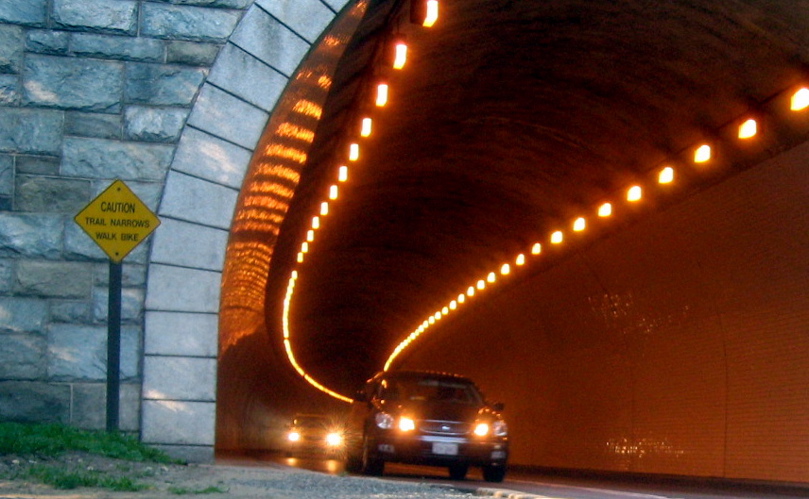
Caution by M.V. Jantzen
"Caution" by M.V. Jantzen

As many people have now realized, the current highway-based, auto-oriented Gaithersburg West sector plan will waste money on unsustainable, outdated forms of growth that will lead to more congestion and auto-centric developments. However, attention must be paid to the serious negative effects I-270 highway expansion will have on areas other than Montgomery County, particularly the District of Columbia. The foregone conclusions of the traffic studies say little about the effects of this decision elsewhere in the region.

The technology companies of Montgomery County have tremendously contributed to the economic growth of the greater Washington region, and more jobs and more vitality in the future are a boon. However, the design of any new developments must also have a positive effect on the rest of the region. Employing effective land use policies, encouraging compact development, and investing in efficient transportation will increase the benefits to the region in many other ways.

Vastly increasing the capacity of highway-scale roads throughout the region will likewise increase the number of automobile trips undertaken. Wider highways up the road will only encourage growth, which will bring calls for I-270 widening closer to the District, just as the highway lobby has pushed planners with good intentions to widen I-66. But that, in turn, will only make trips from further out easier, and so more individuals will opt to drive from further out, filling up the highway. Conversely, any resident of DC that finds a job in the corridor will have to commute from the city by car or move and still commute by car.

But between the Beltway and downtown, where will these drivers go? The project assumes that people will basically commute from Clarksburg to Gaithersburg. Although many will commute within the corridor, history has shown that many will also continue on into DC, into the growing Central Business District. Some, perhaps, will park and ride the Metro or MARC in. But most will simply drive in, pouring cars into the city, onto Wisconsin Avenue, Connecticut Avenue, Beach Drive, Georgia Avenue, Sixteenth Street, River Road, and the Clara Barton Parkway.

The new drivers, passing through the neighborhoods of Northwest will themselves be more traffic, meaning more idling, more speeding, and more side-street cut-throughs. The idling and the stop-start traffic will not only make everyone’s commute harder – the new cars will compete with the excellent bus service in Northwest – the engines will release greenhouse gases and noxious pollutants into the air along the way. Moreover, all the new, frustrated drivers will add more than a few chances for injuries and collisions.

For all the fears that middle-height transit oriented development along corridors in northwest, the sprawlway will have much more severe and lasting consequences for Wards 3 and 4. Politicians and citizens alike need to support rational development, development of a reasonable density, designed for humans, and designed for transit accessibility. Only through TOD can one part of the region grow without adversely affecting the others. But more importantly officials need to coordinate with their peers in Maryland, Virginia, and the District of Columbia to and work together as a whole, the way the economy of the region does. Otherwise, no infrastructure project can be said to benefit the region, especially one with such an adverse impact as the Sprawlway.